Complete Property Intelligence
One Platform · Total Visibility
Delivering faster insights, fewer site visits and accuracy down to the pixel.
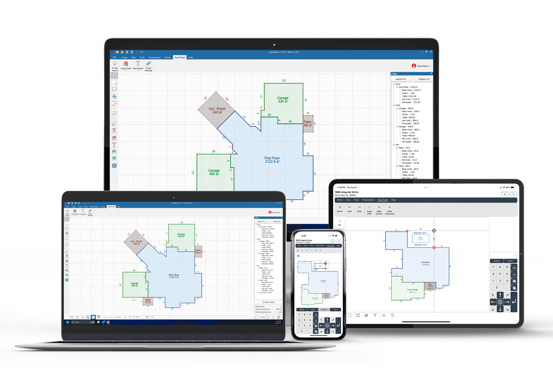
ApexSketch
Professional property sketching, measurement, and ANSI-compliant documentation.
LEARN MORE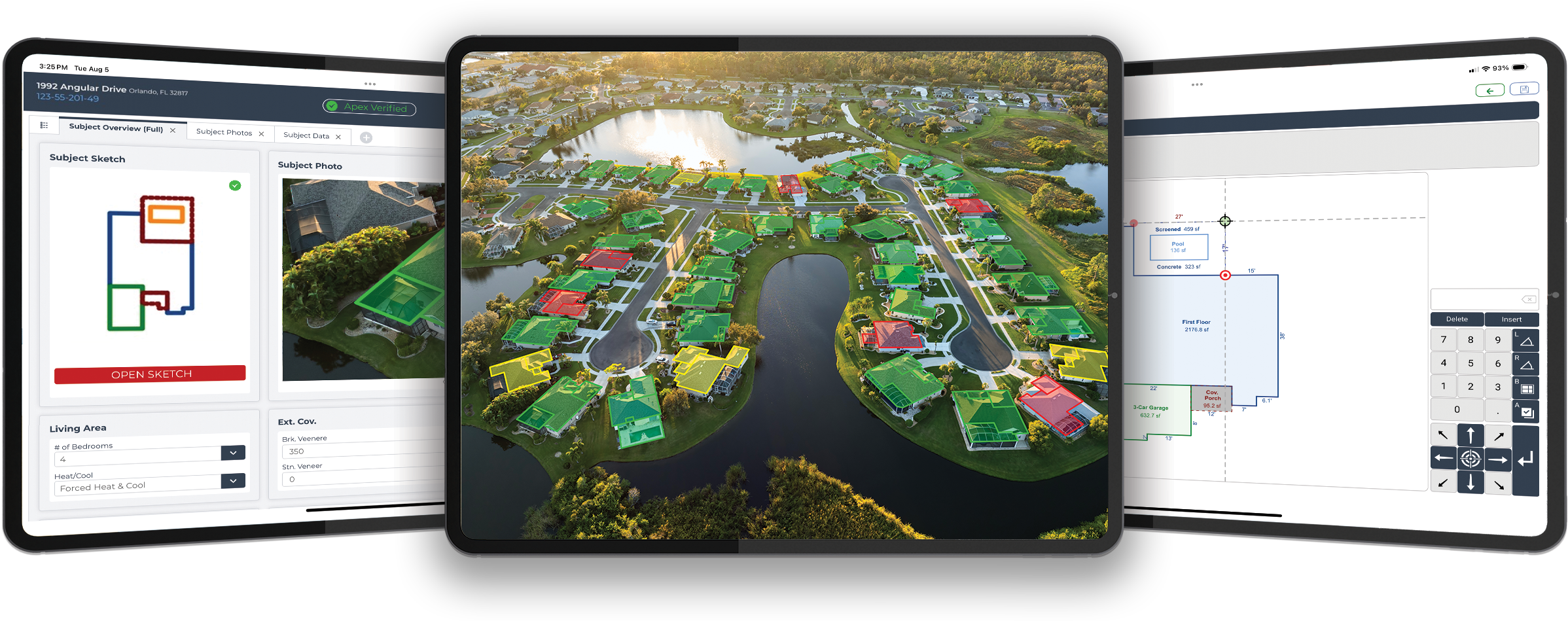
GeoViewPort & StreetScape
All Visual Data, Focussed on subject property, Customised street level imagery collection. Supervised automated workflow. Unmatched efficiency. We will find the needle in your haystack.
LEARN MOREOur Products
Precision instruments for ground-truth verification and property intelligence.
ApexSketch Software
Versatile floor plan drawing software for all sketching needs — seamlessly integrating with most major CAMA & Appraisal Software providers across the United States.
GeoViewPort Suite
Complete content for decision support. Desktop review, workflow management, and mobile field operations in one integrated platform.
StreetScape Imagery
Powerful visual intelligence that supports desktop insights and decision-making while reducing the need for field visits.
Professional Services
Outsource that First Pass Inspection, Georeference and verify accuracy of all of your sketches. Delivered by seasoned professionals that understand data accuracy.
Built for High-Stakes Decisions
Trusted by assessors, appraisers, and planners across the globe.
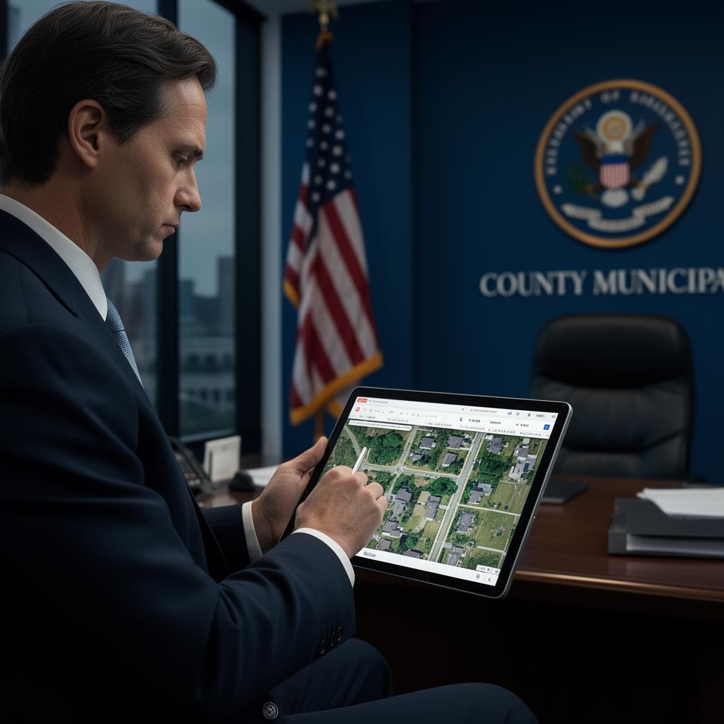
Tax Assessors
Equitable property valuations powered by irrefutable visual evidence. Desktop review, automated workflow, and field-ready tools designed for municipal and county mass appraisal operations.

Independent Fee Appraisers
Professional-grade sketching, measurement, and documentation tools for independent fee appraisers. ANSI-compliant output and seamless portal sync for every assignment.

Lenders & Insurance
Reliable property data and valuation tools that give lenders and insurers confidence in every decision. Streamlined due diligence, accurate measurements, and imagery for underwriting, claims, and lending.